2026 · Personal research project
CekInternet
Connectivity intelligence for location planning.
Compare regional internet performance across Indonesia when considering locations for offices, coworking spaces or remote operations.
The question
How can connectivity evidence help screen a location?
Internet access matters when choosing somewhere to work. I wanted to explore how public measurements could help someone compare candidate areas before checking the connection at an actual office, coworking space or other premises.
That shaped the workflow: find a place, inspect the surrounding area's measurements, and build a shortlist. The project focuses on regional screening.
What I built
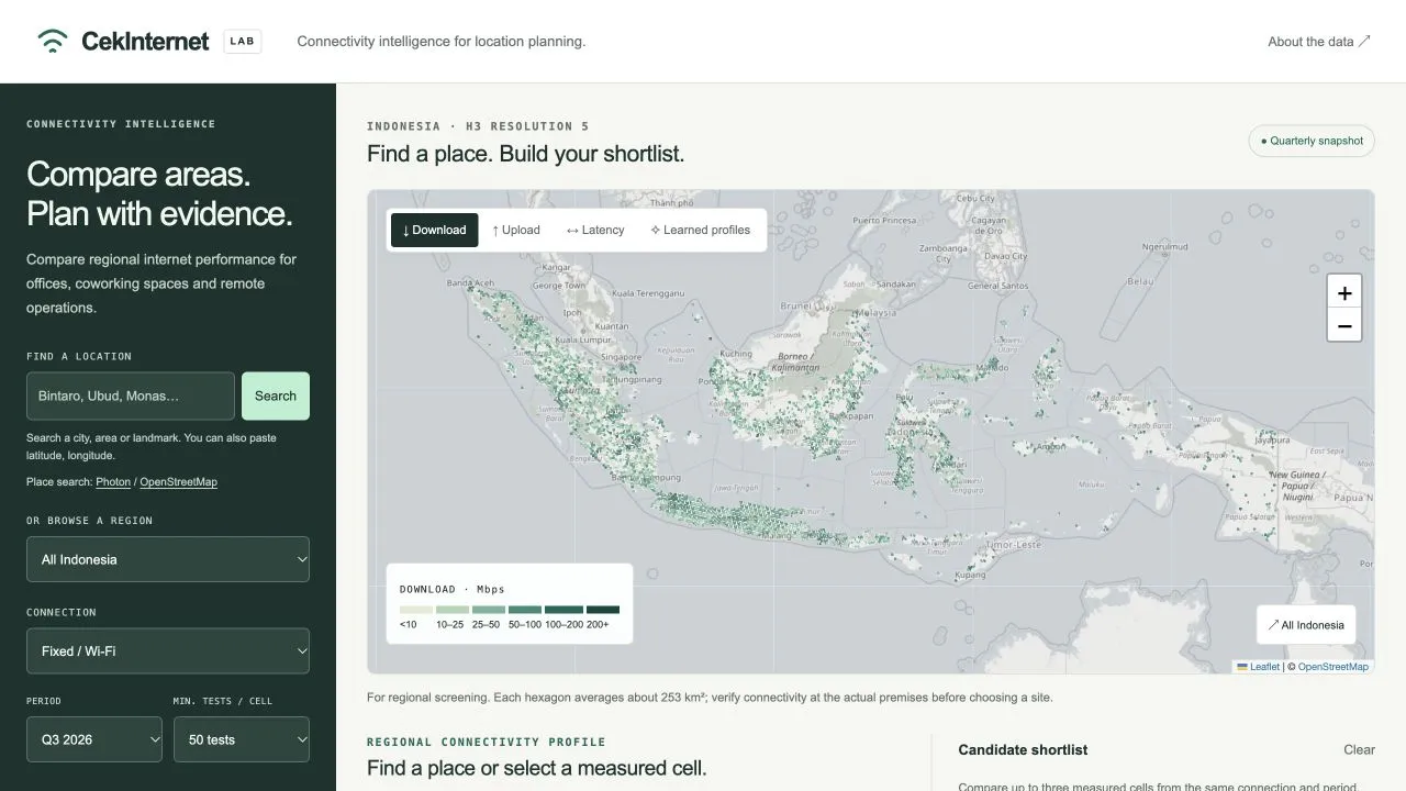
CekInternet brings Ookla's public fixed and mobile internet measurements for Q1 and Q3 2026 into one map. You can compare download speed, upload speed and latency, inspect sample counts, and shortlist up to three areas from the same connection type and period.
Search accepts Indonesian cities, neighborhoods and landmarks, or latitude and longitude. A pin locates the result; its containing hexagon supplies the regional connectivity profile. If measurements are absent or below the selected sample threshold, the app says so.
Design decisions
A shared geographic grid.
Uber H3 groups measurements into comparable hexagonal areas across Indonesia. I chose resolution 5 to make national exploration practical. A cell averages about 253 km² globally, so the interface keeps its regional scale visible. Speeds and latency are weighted by the number of tests in each source tile.
Machine learning with a specific job.
Unsupervised k-means groups measured areas into four connectivity profiles per connection type, using download, upload and latency. The profiles help people explore patterns in the observations. They are descriptive, not forecasts or recommendations about a particular address. Only cells with at least 50 tests receive a learned profile.
Keep missing evidence visible.
Finding a place does not guarantee that it has usable measurements. The app shows the containing cell's coverage and sample count, and avoids filling gaps with a nearby area's results. A blank area means unknown coverage.
Scope & limits
This is a personal, noncommercial research prototype. Crowdsourced measurements reflect who ran tests; large cells can mix urban and rural conditions, and changes between quarters can reflect different samples. More tests do not remove those biases.
Use it to explore and compare regions, then verify connectivity at the actual premises. It cannot rank providers, guarantee household speeds or describe current outages.
Data and adaptations use CC BY-NC-SA 4.0. The app's “About the data” explains the sources, aggregation and model. CekInternet is not affiliated with Ookla.
Try it
Search for Bintaro or Ubud, choose a result, then add its measured area to your shortlist. Compare another area using the same connection type and period.