2026 · Personal utility
Ganjil-Genap Jakarta
A quicker check before driving across Jakarta.
Explore Jakarta’s odd-even corridors, see the current schedule status, and check a planned departure against your plate’s last digit.
The question
Which roads do I need to check before I drive?
I often forget which Jakarta roads fall under ganjil-genap. Before I drive, I find myself checking whether a toll exit might lead onto a restricted corridor and which roads are affected at the time I plan to leave. That means looking up the road list, today’s plate parity, active hours, and holidays again. I built this map to put those checks in one place.
What I built
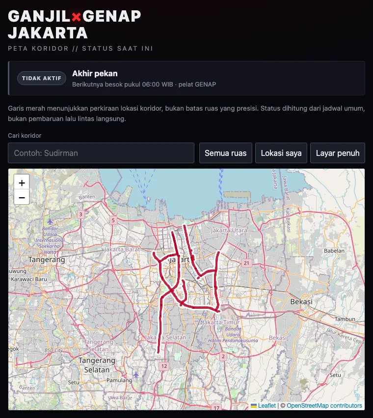
The app highlights the listed corridors on an interactive map. A status panel calculates whether the published weekday schedule is active in Jakarta time, which plate parity matches the date, and when the next window begins. It updates while the page stays open.
Drivers can search the mapped corridors by name, mark their current location, and expand the map to fill the screen. A separate check compares a chosen departure time in WIB with the last digit of their plate. On mobile, the map appears immediately after the compact status panel.
I mapped the 26 official road entries as 25 geographic features because the two sides of Jalan Salemba Raya share one mapped corridor. The road geometry comes from OpenStreetMap; the schedule and corridor list are checked against theJakarta government’s guide, and the 2026 holiday dates against thenational holiday decree. I last checked these sources on 11 October 2026.
Design decisions
Show the roads even when the rule is inactive.
The map still needs to answer “where?” outside enforcement hours. Keeping the corridors visible separates the place from the current schedule.
State what the map can actually tell you.
OpenStreetMap road names are a useful starting point, but a named road can extend beyond the legally restricted segment. The interface labels the lines as approximate and keeps the official source close to the map.
Keep the trip check tied to the published schedule.
The departure-time check answers whether a plate digit matches the rule at that time. It does not claim that a particular journey crosses a restricted segment.
Scope & limits
This is an unofficial reference tool, not turn-by-turn routing or a live government feed. Search covers named mapped corridors, not arbitrary addresses. The app does not detect whether a chosen trip crosses a restricted road, or represent exact junction boundaries, toll access, vehicle exemptions, or temporary suspensions. The holiday data needs annual maintenance. Drivers should follow road signs and current official announcements.
Try it
Search for Sudirman, inspect the corridor, then choose a weekday departure time and your plate’s last digit to check the schedule.